FAQ: Frequently asked questions about Kathrein's RTLS technology
Learn how real-time localization works, how to select the right transponders, map tracking options, and recommended anchor placement for accurate asset location.
Transponders:
What are the dimensions of a transponder?
- The dimensions are 92 mm x 54 mm x 30 mm
How are the transponders stored?
- Ideally out of freezing room temperature for battery life. If they don't have a battery in them, it doesn't matter.
What frequencies does the Kathrein transponder use?
- Kathrein's RTLS transponders use a combination of Ultra-Wideband (UWB), RAIN RFID and NFC technologies. UWB technology provides high localization accuracy down to 25 cm, which is unique to RTLS systems as it allows for greater range and accuracy than other common technologies such as BLE or WLAN. This combination is not commonly available in all RTLS transponders, which makes Kathrein products specific.
How does Kathrein locate a transponder?
- There are two main localization modes: Time of Flight (ToF) and Time Difference of Arrival (TDoA), with TDoA being particularly advantageous for longer battery life, while ToF provides very high accuracy. This approach allows easy integration into existing AutoID systems. However, it has a higher battery consumption.
Battery:
What is the realistic battery life?
- Standard (outside a cooled environment) = 3-5 years in storage. If used outdoors, then up to a quarter of the time they are in cold/freezing conditions, the lifespan drops to 2-3 years.
What batteries are used in transponders?
- Mostly lithium batteries of type CR 123A or similar, which are suitable for long term operation and low power consumption. They are user replaceable as standard. See our e-shop.
How is a low battery indicated?
- You can monitor the status of the device using Kathrein CrossTalk software. You will know in time that the battery is low. It is also possible to turn on the red light signal on the transponder.
Anchors:
What anchor spacing is recommended?
- According to the manufacturer, the anchor range is about 30-40m, but for accurate positioning, three anchors spaced about 10-15m apart are recommended depending on the environment. The exact locations of the anchors (Nodes) will be suggested in consultation with the customer.
What is the IP coverage of the anchors?
- Indoor has IP40, outdoor IP67
Software:
What software is used for transponder overview?
- It's Kathrein CrossTalk software.
For position overview CODEWARE offers a superstructure SW over Kathrein SW. Does it also allow rendering to a map and display on a tablet?
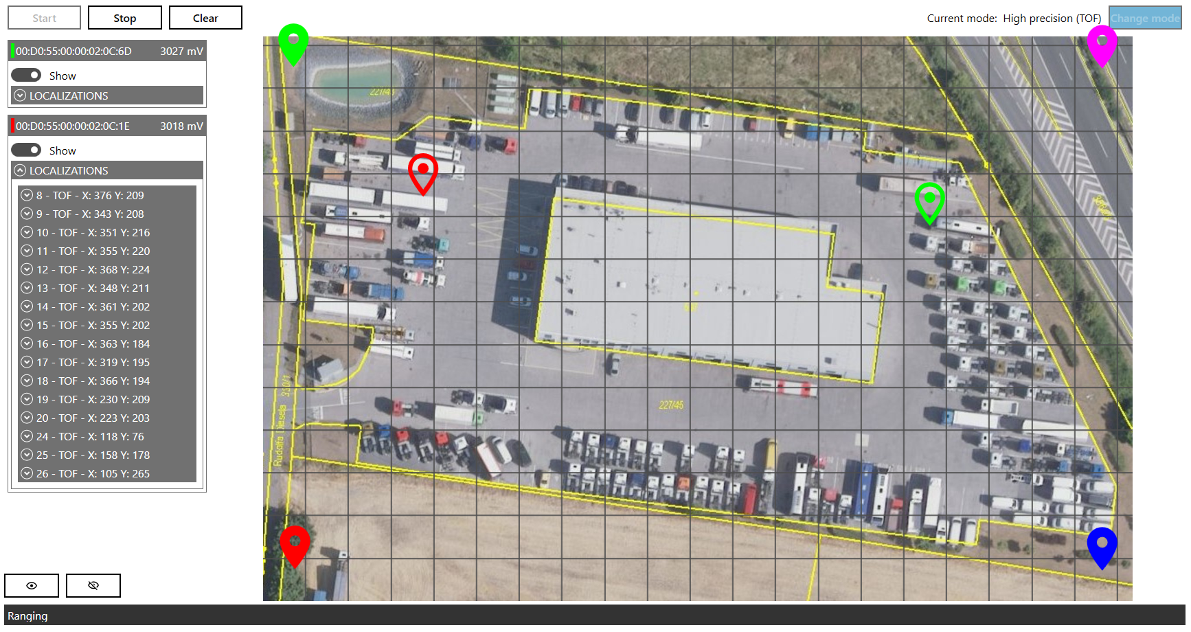
- Yes, this add-on SW will allow the operator to plot the positions of all tags visible by the anchors on the site map on a tablet. It also allows one specific transponder to be traced.
What happens if the transponder leaves the site?
- It is possible to use a classical RFID gateway for an alert (beacon, buzzer). At the same time, the last seen position is displayed on the map.
Is it possible to add management views and reports to the Codeware software?
- Yes, according to the customer's wishes.
Licensing:
Are there fees payable during the use of RTLS?
- No, you purchase hardware and software from Kathrein on a one-time basis and then it's yours. The same applies to CODEWARE software. However, you can purchase SLA as a service where we guarantee a quick response, or you can subscribe for cheaper hours for various reprogramming and changes that the rollout will bring.


